What a master plan means when no plan has been sanctioned
A master plan is a drawing with a sanction stamp on it. Everything below is not that. It is a set of consequences that follow from two circulating figures — 12-plus acres and 1,500-plus homes — plus the density, sizes and mix that this corridor's registered projects actually exhibit.
We publish the arithmetic for three reasons. It shows a buyer what the range of possible outcomes is on a parcel this size, which is genuinely useful before any drawing exists. It makes our estimates falsifiable, so that when a plan appears you can check us against it rather than take our word. And it exposes one constraint — the floor-area consequence in the next-but-one section — that neither the circulating figures nor any competing page has confronted.
What we will not do is manufacture the numbers that only a plan can give. This page publishes no building height in metres, no open-space percentage, no parking-bay count, no clubhouse area, no tree count, no sewage-treatment-plant capacity and no survey number. None of those is derivable from anything we hold, and a plausible-looking invented figure is worse than an honest gap.
Land: the 12-acre figure in circulation, and what the corridor's own density supports
Start with the land, because every other quantity on this page hangs off it.
12 acres × 43,560 sqft = 522,720 sqft of land.
The acreage itself is unconfirmed. The figure circulating ahead of launch is "12-plus" acres; the channel-partner page most often cited for the apartment claims on this holding says 13. We use 12 acres as the central figure and treat 12 to 13 as the honest range.
For density, the corridor answers the question itself. Three high-rise benchmarks are verifiable — two on this road and one from the developer's own portfolio:
| Benchmark | Homes | Acres | Homes per acre |
|---|---|---|---|
| Provident Botanico, Soukya Road, 9 towers | 1,275 | 17.0 | 75.0 |
| Godrej Parkshire, 5 towers of 28 floors | 1,132 | 13.5 | 83.9 |
| Goyal Orchid South Park, Electronic City, 2 towers, registered May 2026 | 350 | 4.0 | 87.5 |
| Mean | 82.1 |
12 acres × 82.1 homes per acre = 985 → about 1,000 apartments, which is the number this site uses.
The alternative reading of the circulating figures — 1,500 homes genuinely on 12 acres — is 125 homes per acre. Measured against the three benchmarks in the table above, each named with what it actually is:
67% above Provident Botanico (75.0/acre), the densest scheme registered on Soukya Road itself 49% above Godrej Parkshire (83.9/acre), the densest in the same taluk code — though it is 8 km north and not on this road 43% above Goyal Orchid South Park (87.5/acre), the densest scheme Goyal & Co | Hariyana Group has built anywhere in Bengaluru
Those three percentages are what 125 ÷ 75.0, 125 ÷ 83.9 and 125 ÷ 87.5 give, and they are the same three figures used on the homepage and the overview page. Wider Bengaluru comparables sit lower still: a 10-acre, three-tower ground-plus-30 scheme runs near 59 homes per acre, and a 12-acre, eight-tower ground-plus-32 scheme near 67. The industry treats 100 per acre as the high-density threshold.
The reconciliation the arithmetic favours is that the two figures describe different scopes. Goyal's Soukya Road holding is described in channel-partner copy as roughly 36 acres, of which the registered villa project accounts for 12.36. Build the remaining 24 acres or so at about 62 homes per acre and you get roughly 1,490 homes. On that reading, 12-plus acres is the phase in the market and 1,500-plus is the whole holding across more than one phase — and both circulating numbers are true of different things. We do not publish 125 homes per acre as this project's density in any form.
The floor-area consequence nobody has published
Here is the part that follows from the density question and that no page on this corridor states. Density is a headline; floor area is the constraint that decides whether a density is buildable at all.
At the indicative mix — roughly 35% two-bedroom at 1,200 sqft and 65% three-bedroom at 1,650 sqft — the weighted average home is:
(0.35 × 1,200) + (0.65 × 1,650) = 420 + 1,072.5 = 1,492.5 sqft.
Apply that to both readings of the circulating figures:
| Scenario | Homes | Saleable area | Saleable ÷ plot | Implied FAR (÷1.30) |
|---|---|---|---|---|
| Our estimate for this project | 1,000 | 1,492,500 sqft | 2.86 | about 2.2 |
| The circulating figures read literally | 1,500 | 2,238,750 sqft | 4.28 | about 3.3 |
Assumptions, named. Super built-up saleable area typically carries 25–30% loading over carpet, and basements, service floors and parts of the common areas do not count towards floor-area ratio — so built-up area for FAR purposes is roughly saleable divided by 1.30. Change that divisor and both FAR figures move together; the ratio between them does not. The saleable-area totals in that table are outputs of our own arithmetic, not published figures, and they are the only sense in which this site quotes a built-up area at all.
A floor-area ratio around 2.2 is unremarkable for a large group-housing parcel with main-road frontage. A ratio around 3.3 would sit at the very top of the Bengaluru Development Authority's own base-FAR regime — on land that is not under BDA or BBMP jurisdiction at all. We could not establish the Hoskote Planning Authority's floor-area cap for this parcel, and rather than assume it in either direction we state the gap. What survives regardless of the answer: the two readings of the circulating figures imply building envelopes that differ by about 50%, and only one of them is ordinary for this corridor.
If you are shown a plan, this is the single most efficient check on it. Total saleable area divided by plot area, compared against the sanctioned FAR on the approval, tells you in one line whether the unit count you have been quoted is consistent with the land.
Towers, plates and basements: the massing arithmetic
From about 1,000 homes, the massing follows:
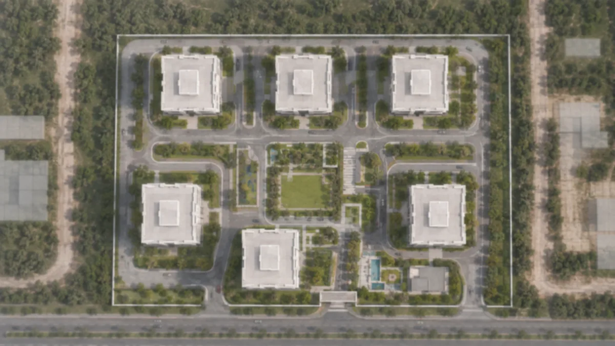
1,000 homes ÷ 6 towers = 167 homes per tower 167 homes ÷ 24 upper floors = 6.9 → about 7 homes on a typical floor plate
Seven homes on a plate is an ordinary two- and three-bedroom core-and-corridor layout — two lifts and a staircase serving a short double-loaded corridor. It is not an unusual or strained configuration, which is part of why six towers is our central figure.
The cross-checks are consistent. Godrej Parkshire runs 1,132 homes across 5 towers of 28 floors, about 226 per tower and roughly 8 per plate. Provident Botanico runs 1,275 across 9 towers, about 142 per tower. Six towers of 167 sits between them.
| Massing element | Indicative figure | Honest range |
|---|---|---|
| Towers | 6 | 5–8 |
| Levels | 2 basements + ground + 24 upper floors | G+20 to G+28 |
| Homes per tower | about 167 | — |
| Homes per typical plate | about 7 | — |
Assumptions, named: a single uniform tower type, no podium-level retail, and no separate low-rise cluster on the parcel. Any one of those would change the split without changing the total — eight shorter towers, or five taller ones, produce the same 1,000 homes and a materially different site. We publish no height in metres, because a metre figure implies a floor-to-floor dimension and a sanctioned envelope, and we have neither.
Ground plane: footprint, circulation and parking
The one ground-plane quantity that the arithmetic reaches is the tower footprint, and it is worth setting out precisely because it is so often confused with something it is not.
7 homes × 1,492.5 sqft ≈ 10,450 sqft of saleable area on a typical plate 6 towers × 10,450 sqft ≈ 62,700 sqft ≈ 1.44 acres of tower footprint, against a 12-acre parcel
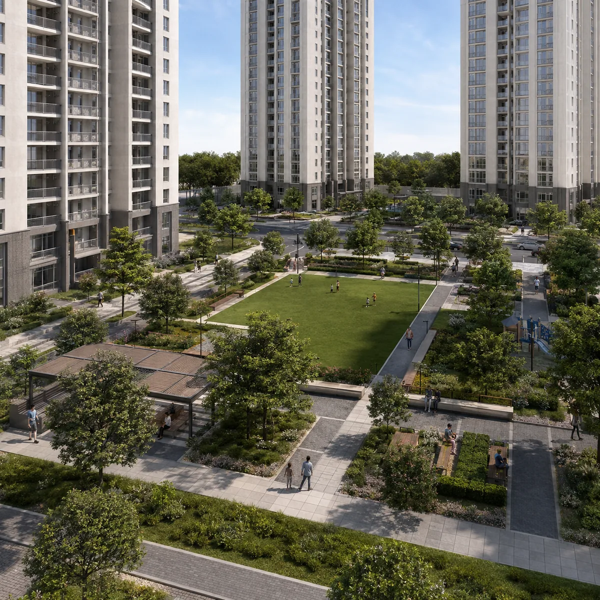
That is a footprint estimate, not an open-space figure, and it must not be read as one. The ground plane of a project this size also has to absorb the driveway loop and fire-tender path, the basement ramps, visitor and surface parking, the amenity block, the entrance plaza and gatehouse, transformer and diesel-generator yards, the sewage treatment plant and organic-waste facility, the sump and pump room, setbacks on every boundary, and whatever civic amenity or buffer reservation the sanction imposes. None of those is sizeable from anything we hold. We publish no open-space percentage for this project, and no one honestly can until a plan is stamped.
The same discipline applies to parking. Two basements is a corridor-normal structure for a 12-acre high-rise scheme and it is what we indicate, but it is an assumption, not a datum — and we publish no bay count, because a bay count comes from a parking layout drawing and a sanctioned norm, not from a unit count multiplied by a rule of thumb. What a buyer can usefully do instead is ask the right questions of whatever plan finally appears:
- How many bays per home, and are they covered, stacked or mechanical? A stack-parked or puzzle-parked bay is not equivalent to an independent one, and the difference shows up on resale.
- How many entry and exit gates, and are service and resident movement separated? A single gate onto a two-lane secondary road is a real constraint at peak hours; Soukya Road is tagged as a secondary road with no lane count recorded, and no widening scheme for the road itself could be sourced.
- Where do the ramps land, and how far is the longest walk from a parked car to a lift lobby? On a 12-acre plate this is often the difference between a good and a mediocre daily experience.
- What is the visitor-parking provision, and is it inside the basement or on the driveway? Surface visitor parking eats the landscape the brochure sells.
Phasing: why the circulating 12 acres and 1,500 homes can both be true
Phasing is the most likely explanation of the circulating figures, and it has consequences a buyer should understand before signing anything, whichever project on this corridor they end up in.
The developer's own registered project on this holding is itself a phase: Riviera Uno is 12.36 acres described as Phase 1 within a claimed larger parcel. If the apartment component follows the same pattern, a 12-acre phase now and further phases later is exactly how a whole-holding figure of 1,500-plus homes and a phase figure of 12-plus acres coexist without either being wrong.
Three things follow, and they are general truths about phased projects rather than claims about this one:
- Karnataka RERA registers phases separately. Each phase gets its own registration number, its own declared completion date and its own promoter obligations. A number quoted at you may belong to a phase you are not buying in.
- Shared amenities often sit in the last phase. The clubhouse, the sports courts and the larger landscape frequently land with the final phase, which can be years after the first tower is handed over. Ask which phase carries the amenity block on the approved plan.
- Density is a whole-site outcome, not a per-phase one. If early phases are built at a comfortable density and the balance land carries the remainder, the site you move into and the site you eventually live in are different places. Ask for the phasing plan, not just your own phase's plan.
Goyal Riviera Uno: the one registered project on this holding
Goyal Riviera Uno is the only Goyal & Co project on Soukya Road that survives checking against both the developer's own portfolio and the state registry, and it is the best available evidence of how this developer treats this land.
- Registration
PRM/KA/RERA/1250/304/PR/060225/007489, registered 6 February 2025, promoter of record NIRVANA DEVELOPERS, marketed by Goyal & Co | Hariyana Group as Riviera Uno. - 12.36 acres, described as Phase 1 within a claimed roughly 36-acre parcel.
- 130 to 137 four-bedroom villas of 3,450 to 3,490 sqft, at about Rs 4.2 to 4.3 crore — an implied rate of about Rs 12,034 per sqft, taken as Rs 4.2 crore over 3,490 sqft. That is the single figure used for Riviera Uno everywhere on this site, including the price page's third rate-derivation method.
- Possession stated as about January 2030.
Two readings a buyer should take from it. First, the developer does register before it markets on this road, which is the correct sequence and is the reason the absence of a registration for the apartment project is meaningful rather than routine. Second, the promoter string carries no Goyal or Hariyana token — so anyone verifying "is this really a Goyal project" against the registry will get a confusing answer unless they know to match the number rather than the brand. Whether NIRVANA DEVELOPERS is a wholly controlled Goyal vehicle or a landowner in a joint-development arrangement is not documented in anything we could source, and if it is the latter, it would also explain why a township on this holding might be assembled parcel by parcel with different partners.
Goyal Royale Ville, Orchid Soukya Road and the rest of the township claim
The "36-acre integrated township" framing usually arrives as a four-project table. Checked against the developer's own residential listing and against all 9,880 rows of the Karnataka registry, it does not hold up.
| Claimed project | On the developer's own portfolio? | In the Karnataka RERA registry? | Position |
|---|---|---|---|
| Goyal Riviera Uno | Yes | Yes — PRM/KA/RERA/1250/304/PR/060225/007489 | Real and registered |
| Goyal Royale Ville | No | No — zero matches on the name | Channel-partner claim only |
| Goyal Riviera Apartments, Soukya Road | No | No — zero matches on the name | Channel-partner claim only |
| Goyal Orchid Soukya Road | No | No — zero matches on the name | Channel-partner claim only |
The source quality behind the three unverified rows is worth stating plainly, because it is testable. One of the Royale Ville microsites now serves content for an unrelated project on Kanakapura Road; a second no longer resolves in DNS. The page carrying the Riviera Apartments figures declares on itself that it is "just for the purpose of information only and not to be considered as an official website", shows no registration number, and states 13 acres where the claim is usually quoted at around 10. There is also a real possibility that "Royale Ville" is a marketing alias for the registered villa cluster rather than a separate development — the villa count quoted for it is the same figure one source gives for Riviera Uno's first phase.
So the honest description of this holding is: one registered villa project, a claimed township around it that rests on marketing copy, and an apartment project that has not been announced by the developer at all. Where this site refers to the township, it refers to it as a claim with the claimant named.
One naming caution that matters when you search. Both of this developer's signature brand words are also used by an unrelated Devanahalli developer, whose Riviera- and Orchid-branded registrations sit under taluk code 1250/303. The Soukya Road land is 1250/304. The reliable way to tell two similarly named projects apart is the taluk code and the promoter string on the registration, not the brand word.
Water, power and treatment: the infrastructure this parcel builds itself
This is where the jurisdiction stops being a technicality.
Water. Cauvery Stage V serves the 110 villages added to BBMP, adding 775 MLD; by mid-2026 roughly 89,000 connections had been made and 104 of the 110 villages were receiving water, with about 600 m of the 110.6 km trunk main still unlaid and the Kadugodi ground-level reservoir delayed by land acquisition. All of that describes a scheme whose boundary is BBMP's. Thirumalashettihalli, Samethanahalli and Koralur are in Hoskote taluk, outside BBMP, and therefore outside the scheme. Borewell supply with tanker top-up is the realistic base case for this belt. A project here will stand or fall on its own bore yield, its sump and pumping capacity, its treatment train and its recharge design. Ask for the yield test, ask how many bores and at what depth, and ask what the tanker budget assumption is in the maintenance charge.
Sewage. For the same reason there is no municipal sewer to connect to. A project of this size treats and disposes of its own sewage, which means an on-site sewage treatment plant, consent to operate from the Karnataka State Pollution Control Board, and a plan for where treated water goes — landscape irrigation and flushing, typically. We publish no plant capacity, because that comes from the approved drawing. What to ask: the technology, where the plant sits relative to the nearest tower, and whether treated-water reuse is plumbed as a dual line or retrofitted later.
Power. Supply is Bescom's, and a scheme of this scale needs its own transformer yard and diesel-generator backup. We publish no generator capacity or backup-per-home figure. The question worth asking is what backup covers — lifts, pumps and common areas only, or a per-home allowance, and at what tariff.
Rainwater. Given the water position, recharge is not an amenity here, it is part of the water strategy. Ask whether harvesting feeds recharge pits, storage, or both, and how it is sized against the roof and paved area.
Stormwater and the flooding question
The Whitefield belt flooded in May 2026. Flash flooding on 22 May 2026 hit Whitefield among the worst-affected areas of the city, with the Whitefield-Hoskote arterial waterlogged, following another inundation event a few days earlier under an IMD yellow alert. Reporting and residents attribute the repetition to choked and encroached rajakaluves — the stormwater drains that carry the belt's runoff between tanks.
For a master plan on a 12-acre parcel here, that turns three drawing-level questions into buyer-level ones:
- Does any rajakaluve or its buffer cross or abut the parcel? This is visible on the sanctioned layout and on the revenue map, and it constrains what can be built where.
- Where does the site's stormwater discharge to, and what is downstream? A site that solves its own drainage by pushing water onto a village road has not solved it.
- What are the finished ground levels relative to the road and the surrounding land? Basement entry levels and ramp thresholds are where flood damage actually happens.
None of these is answerable today for this project. All three are answerable in ten minutes from a sanctioned plan, which is why they belong on the list of things to ask for rather than in a paragraph of reassurance.
"BMRDA approved" — what it means here, and what it does not
This corridor's approval language is a frequent source of confusion, and it is worth being exact.
Thirumalashettyhalli and Samethanahalli return Hoskote taluk in official geocoding, with PIN 560067. Hoskote taluk falls outside both BBMP and BDA. Under the Bangalore Metropolitan Region Development Authority sit twelve Local Planning Authorities, one of which is the Hoskote Planning Authority, with its office on Mission Hospital Road, Hoskote 562114. That Local Planning Authority — not BMRDA itself as a body, and certainly not BDA — is what sanctions plans and layouts on this land. The Kadugodi and Hope Farm end of the same corridor is a different jurisdiction again, sitting under Bengaluru East City Corporation following the 2025 governance reorganisation.
So when marketing says "BMRDA approved", the accurate reading is that the relevant Local Planning Authority has sanctioned the plan under the regional framework. Three consequences:
- It is not the same as BDA approval, and the two are not interchangeable in the way brochures sometimes imply.
- Khata class and the property-tax route follow the jurisdiction, not the marketing. Ask which body issues the khata for this parcel and in what form, including whether an e-khata is available, because that is what a resale buyer's lawyer will ask you for.
- The approval is checkable. Ask for the sanction number and the issuing authority's name on the drawing, and verify it with the authority rather than accepting a stamped-looking PDF.
The registry codes are a useful cross-check on all of this. Registered projects in this taluk carry the Karnataka RERA code 1250/304 — Birla Alokya, Provident Botanico, Godrej Parkshire, Sobha OneWorld and Goyal's own Riviera Uno all do. The Devanahalli belt carries 1250/303. That two-part code is a district and a taluk code; the mapping is derived from the registry's own structure rather than from a published legend, and we say so, but it is consistent across thousands of rows and it is the cleanest mechanical way to confirm that a project is where it says it is.
The sanction position, and how it becomes checkable
Nothing about the approvals for this project is public today. There is no published plan sanction, no commencement certificate, and no Karnataka RERA registration — and that last absence is the reason for the first two, because registration is what forces those documents into a place any buyer can read them.
The mechanism is worth understanding, because it changes what you should wait for. To register a project, a promoter has to file the approved plans, the layout, the approvals obtained and the declared completion date with the authority, and those filings become the reference point against which the project is later measured. Until that happens, no document about this parcel is publicly verifiable, no completion date binds anyone, and under Section 3 of the Real Estate (Regulation and Development) Act 2016 a project of this size may not lawfully be advertised, booked or sold. No booking amount, allotment letter or agreement to sell can be executed until a registration number is issued. Verify the position at rera.karnataka.gov.in.
The corridor suggests the wait is real but not indefinite: registrations under this taluk code ran 29 in 2022, 26 in 2023, 27 in 2024, 41 in 2025 and 34 in the first seven months of 2026. Supply here is accelerating, and this developer has registered before marketing on this road once already.
Other Soukya Road projects, and what their plans show
Since no plan exists for this one, the most useful reference points are the two nearby schemes whose plans are registered and whose numbers can be checked.
| Project | Parcel | Structure | Homes | Registration |
|---|---|---|---|---|
| Provident Botanico, Soukya Road | 17 acres | 9 high-rise towers | 1,275 in 2 and 3 BHK, 986–1,480 sqft | PRM/KA/RERA/1250/304/PR/210324/006726 |
| Birla Alokya, Thirumalashettyhalli | 7.9 acres | Low-rise villaments plus one clubhouse | 218 in 3 and 4 BHK duplex | PRM/KA/RERA/1250/304/PR/190724/002725 |
| Godrej Parkshire, about 8 km north — not on this road | 13.5 acres | 5 towers of 28 floors | 1,132 in 2 and 3 BHK | PRM/KA/RERA/1250/304/PR/090126/008393 |
Two of those are worth reading carefully rather than glancing at. Birla Alokya is finished stock — possession began in August 2023 and its price line is "Rs 2.15 Cr* onwards" — and it is included here as the neighbouring landmark whose ground-plane approach shows what 7.9 acres of low-rise on this soil looks like, not as a live comparison. Godrej Parkshire is included for its tower structure only; its specifications come from listing aggregators rather than the developer, and it sits about 8 km north of this belt, within 0.2 km of NH-648 and nowhere near Soukya Road.
What to ask for when a plan is finally shown
- The sanction stamp — issuing authority, sanction number and date. Verify it with the Hoskote Planning Authority, not with the seller.
- Plot area against the title documents, so that the acreage on the drawing matches the land actually held.
- Total saleable area and the sanctioned FAR, and run the division yourself. This is the single fastest test of whether a quoted unit count is consistent with the parcel.
- The phasing plan, including which phase you are buying in, which phase carries the clubhouse, and what the whole-site unit count will be at completion.
- The tower schedule — number of towers, levels each, homes per floor, and the distance between towers.
- The parking layout, with bays per home and their type, ramp positions and gate arrangement.
- The services layout — sewage treatment plant, sump, transformer and generator yard positions relative to the towers, and the treated-water reuse route.
- Levels and drainage, including finished floor levels relative to the road and where stormwater discharges, given the belt's May 2026 flooding.
- The Karnataka RERA registration number, in the form
PRM/KA/RERA/.../PR/..., with the promoter of record named on it. Match the promoter string, not the brand.
A note on the figures on this page
The acreage, unit count, tower count, floor levels, unit sizes and mix used above are either the figures circulating ahead of launch or our own arithmetic from the corridor's registered projects, and every one of them is labelled at the point of use. There is no sanctioned plan for this project, so nothing here is confirmed against one. Corridor facts, jurisdiction, infrastructure position and the registered neighbouring projects with their registration numbers and holders are verified against primary sources and stated plainly. Where a quantity would require a drawing — height, open space, parking bays, plant capacities, tree cover, survey numbers — this page says so and stops, and it should keep doing that until Goyal & Co | Hariyana Group publishes the drawing.
Enquire about Goyal Soukya Road
Register a non-binding interest and we will send you the survey numbers, the sanctioned layout, the Hoskote Planning Authority sanction letter and the Karnataka RERA certificate as each one appears. Until they do, we will say so plainly rather than fill the gap with a brochure figure.
Register Your InterestGoyal Soukya Road Master Plan – Frequently Asked Questions
Has the STRR (NH-648) Hoskote to Hosur stretch opened, and how close does it run?
It runs 0.78 km from this belt in a straight line, which is the corridor's largest structural advantage and is routinely understated — one widely circulated figure puts the ramp at 6 to 8 km, roughly an order of magnitude out. The caveat is larger than the advantage. The 80 km Dabaspete–Hoskote section of the Satellite Town Ring Road was inaugurated on 11 March 2024 and is open. The section that actually passes Soukya Road, Hoskote to the Tamil Nadu border, was not open on the most recent reporting we could verify: 20.25 km of 20.9 km complete, blocked by a gap of roughly 650 m at a rail overbridge, targeted for June 2026 after a slip of about sixteen months. That is a dated, checkable status rather than an open-ended promise, and it is the fact on this corridor most likely to have changed — check it on the day you visit rather than taking it from this page.
Is Goyal Riviera Glade the same project as the Soukya Road one?
No, and the confusion is worth clearing because "Riviera" carries no locational signal at all. Riviera Glade is at Sir M Visvesvaraya Institute Road in the Yelahanka and Bettahalasur belt of North Bengaluru, roughly 35 km from Soukya Road: about 9 acres, 110 four-bedroom triplex row villas of 3,190 to 3,550 sqft at Rs 6.06 to 6.89 crore, registered PRM/KA/RERA/1251/472/PR/040326/008503 with possession stated for December 2030. Wrong corridor, wrong format, wrong scale and wrong price band. The same brand word also appears on Goyal's Ahmedabad projects, and — a genuine decoy this — a promoter called GSG Realty holds both Riviera Sky and the Orchid Nirvana series in Devanahalli under a different taluk code entirely, 1250/303 rather than Hoskote's 1250/304. Whether GSG Realty is unrelated to Goyal or is another firm in the same promoter pattern is not established: the registry files those projects under GSG, while Goyal's own awards page claims Orchid Nirvana 2.0 / 3.0 as its own. Either way the instruction is the same — check the taluk code and the promoter string, never the brand word.
How far is Kempegowda International Airport, and how long does it really take?
Kempegowda International Airport is 43.5 km by road, which a routing engine puts at about 41 minutes free-flow. That number describes an empty road at three in the morning and should not be planned against. Allow 60 to 90 minutes for a flight, and more if your route crosses the city rather than running north. If and when the Hoskote-to-Tamil-Nadu-border section of NH-648 opens, an orbital route towards the northern belt becomes available that avoids the city entirely — which would improve this figure materially. Until then, any single airport number quoted for East Bengaluru without that qualification is quoting software rather than a journey.
Is Soukya Road the same as the Whitefield-Hoskote Road?
No, and this is the single most common error made about the corridor. Soukya Road is the east–west axis running from Hope Farm junction towards Chikka Tirupathi — 9.7 km by road from Hope Farm to its eastern end, and about 20.1 km on to Chikka Tirupathi. The Whitefield–Hoskote road is SH-35, a separate corridor running north from the same junction through Kadugodi, Belathur and Kannamangala to Hoskote town, 14.0 km from Hope Farm. The two share only that junction. A BMTC stop at the western end is literally signed "Hope Farm (Towards Chikka Thirupathi)". If a page describes this project as being on the road to Hoskote, it is describing a different road and its distances will be wrong.
What is the difference between Goyal & Co and Goyal & Co | Hariyana Group, and how many Bengaluru projects are there?
Goyal & Co was founded in Ahmedabad in 1971 and lists 40 residential projects there, 15 in Bengaluru and 3 in Mumbai. The Bengaluru business trades as the joint venture Goyal & Co | Hariyana Group with the BSE-listed Hariyana Group, from an office at Barton Centre on MG Road. Its 11 Karnataka registrations are held through six separately named entities — Goyal Hariyana Constructions, Infrastructures, Realty, Associates, Enterprises and Developers — which is an ordinary special-purpose-vehicle pattern, one entity per project. There is no entity called "Goyal & Co Construction" in the registry or on the official site, and we obtained no CIN for any of the six, so their legal form is not something this page will assert.